By Aidan Daly (Science Teacher, Dean of Academics, and OA Semester 42 Alum) One of my favorite…
Brief History of Little River Valley and Surrounding Area
HISTORY
![]()
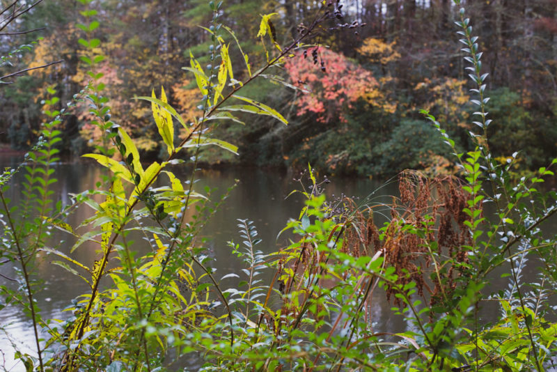
In 1927, Mrs. Oppenheimer purchased the land, on which we currently run Eagle’s Nest Camp and The Outdoor Academy, moving the camp from Eagle’s Nest Mountain in Haywood County, North Carolina to the current location in the Little River Valley. Though Eagle’s Nest has run programs on this land for nearly 100 years, this land has a much longer and significant history. It is the ancestral land for the Cherokee, which are now divided into three federally recognized nations: the United Keetoowah Band of Cherokee Indians (UKB) in Oklahoma, the Cherokee Nation (CN) in Oklahoma, and the Eastern Band of Cherokee Indians (EBCI) in North Carolina. As an organization, Eagle’s Nest is committed to learning and sharing more information about the history of the land. As part of this, we feel that it’s important to share a very brief history of the Indigenous peoples who, at one point in history, made this land in the Little River Valley their home.
Brief History of Little River Valley and Surrounding Area
Prior to contact with European colonizers during the Pre-Columbian era (1500s) in North America, the majority of land in eastern North America was occupied by Indians. On the eve of European arrival in North America (1492), Indian country was home to about two million Native peoples. By 1750, the population of Europeans and enslaved Africans reached 1.25 million while the Native population had declined to 250,000. The landscape of North America by European arrival in the late 15th century, was dominated by established permanent settlements located in close proximity to transit routes via streams or rivers with Indians practicing a mixture of hunting and gathering along with experimentations in settled agricultural cultivation.
By the start of the Mississippian Period, around 1,000CE a warming period in North America paved the way to an Agricultural Revolution among Native populations leading to a focus on the cultivation of the “Three Sisters” crops, which were maize, beans, and squash. This Agricultural Revolution led to the creation of Indian urban centers with highly stratified societies organized around chiefdoms as the primary political and social systems in North America. These Indian urban centers typically included widespread and complex trading networks located along rivers or streams, expert artisanry, and burial mounds that depicted ornate mortuary rituals, and were sustained by planned crop cultivation. By the beginning of the Mississippian Period, the natural environments in North America were constructed and manufactured by Native peoples to meet the needs of their individual and distinct nations or communities, which were interconnected via trade routes and massive roadways that had been cleared by Indians through the use of fire. By this time, Indians had also used fire to extend grasslands to attract hunting game and construct garden plots for cultivating crops showcasing an intricate and sophisticated organization of the natural environment. Many first-hand accounts by European explorers in the Americas detail the clear intentionality by Native peoples in the development of infrastructure, which was then used by Europeans in their colonizing efforts.
By the middle of the 14th century, or the Late Mississippian Period, a “Little Ice Age” occurred in North America continuing into the mid 19th century. As a result, many of the Indian urban centers, characteristic of the Early Mississippian Period, had fallen into decline due to a decrease in agricultural productivity. Consequently, Native populations began to disperse outwardly. This resulted in the transition from centralized urban centers to diverse and decentralized Indian villages ranging from 500 to 2,000 occupants. Consequently, distinct linguistic groups dominated particular regions of Eastern North America. Eastward were the Siouan speakers in the southern Piedmont and the Iroquoian speakers, who were divided between a group consisting of the ancestors of the Cherokees and those of the Tuscaroras in present-day Georgia, Tennessee, and North Carolina.
Around 1540 Hernando De Soto, who was a Spanish explorer, traveled throughout various parts of present-day Western North Carolina in his quest for gold for the Spanish crown. Through his explorations in Western North Carolina, De Soto came into contact with American Indian communities in this area seizing food supplies and enslaving many Indian peoples in the region.
Centuries later, the French and Indian War was fought between 1754 and 1763, or Seven Years’ War declared between Britain and France from 1756-1763, between the British and French along with their Indian allies over land in North America. Initially, Cherokee people allied with the British against the French but eventually supported the French as a result of rampant violence by British settlers against Cherokee people and villages. By the late 18th century, the Cherokee nation, east of the Appalachians, was a series of villages that operated independently of one another and were centralized around a clan system.
Between 1760 and 1761, the Cherokee Nation attacked British squatter settlements near Bethabara and along the Yadkin and Dan Rivers in North Carolina, while, in turn, British forces destroyed Cherokee villages, including the Cherokee capital Etchoe. In 1761, the Cherokee Nation signed a treaty with the British ending the war between the Cherokee Nation and the American colonists.
The Treaty of Paris, signed in 1763, officially ended the French and Indian War with the French ceding all territory east of the Mississippi River to the British. After 1763, without the threat of the French, British settlers pushed west of the Appalachian Mountains further encroaching on Cherokee land.
In 1776, the North Carolina delegation to the Continental Congress issued a proclamation declaring war against the Cherokee Nation, invading Cherokee land and destroying Cherokee villages and towns. Between the summer and fall of 1776, over five thousand colonial troops invaded and destroyed Cherokee land and massacred a large number of Cherokee people. In 1777, the Cherokee Nation entered into a treaty with federal troops called the Treaty of Long Island of Holston. In this treaty, the Cherokee Nation ceded territory east of the Blue Ridge Mountains and along Watauga, Nolichucky, Upper Holston, and New Rivers to the US government.
In 1783 with the Treaty of Paris, the British officially recognized the independence of the United States thereby ending the American War of Independence (1775-1783). With the Treaty of Paris, all land south of the Great Lakes, east of the Mississippi, and north of the Floridas, which were returned to the Spanish, were transferred to the new nation of the United States. Despite the Treaty of Long Island of Holston, in the newly independent United States, the North Carolina assembly declared lands, which had been fixed as boundaries reserved for the Cherokee Nation, open for settlement.
Confronted by the squatter-settler encroachments, in 1791, representatives of the Cherokee Nation signed the Treaty of Holston whereby they ceded additional land to the US government in exchange for establishing the Cherokee Nation as a protectorate of the US as well as delivery of valuable goods and $1,000 to be paid annually to the Cherokee Nation and its descendants.
Faced with continued intrusion of settlers on Indian land, in 1798, the Cherokee nation ceded an additional triangular area near Indian Gap, east of present-day Brevard, and southeast of Asheville. In return the Cherokee Nation would receive $5,000 in cash and a $1,000 annuity forever.
By the end of the 1780s, armed settlers had annihilated Cherokee populations, towns, and villages throughout Virginia and North Carolina. During this period, many Cherokees fled west from their homelands to escape the rampant brutality enacted by the colonial troops. In 1817, the Cherokee nation ceded additional land in exchange for land on the Arkansas River, and 2,000 Cherokees moved west.
With the official recognition of the United States by the British in 1783 (ending the American War of Independence 1775-1783), all alliances and treaties that had been forged over the previous two decades between the British colonial government and Native Peoples were rendered void paving the way to the creation of an emergent republic that excluded Native populations and ignored Native rights to land.
In 1803, with the Louisiana Purchase, the United States purchased land west of the Mississippi River from the French doubling the size of the United States and setting off a period of intense westward expansion coupled with the explosion in cotton cultivation and the expansion of slavery westward.
Having acquired territory west of the Mississippi from the French with the Louisiana Purchase in 1803, and desiring to remove Indians from their homelands east of the Mississippi, which was the heart of “Cotton Kingdom,” or land rich for the production of cotton, in 1830, President Andrew Jackson signed into law the Indian Removal Act. With the Indian Removal Act it became lawful for the President of the United States to exchange lands where Indians currently resided east of the Mississippi River with land west of the Mississippi.
Faced with mounting pressure from the US government, which was backed by the Indian Removal Act, a minority group within the Cherokee Nation (about 500 of the 16,000 member nation) negotiated a treaty with the United States whereby they ceded all Cherokee lands of about seven million acres east of the Mississippi for five million dollars and land in present-day Oklahoma. This treaty became known as the Treaty of New Echota and was signed in Georgia in 1835 providing two years for the Cherokee people to leave their homelands in the east.
In 1836, the Cherokee National Council, backed by a petition of 15,000 Cherokee signatures representing nearly the entirety of the Cherokee population, voted to reject the Treaty of Echota since the majority of the Cherokee Nation disagreed with it. The Cherokee National Council submitted a petition to Congress requesting the treaty be voided.
By 1838, which marked the two year limit for leaving this land, President Martin Van Buren, who would become President after Jackson, ordered that federal troops remove Cherokee people by force. This became known as the “Trail of Tears” that resulted in the deaths of over 4,000 Cherokee people, from among the approximately 16,000 who were pushed west, during the 1,200 mile trek that took place over a period of six months from the remaining Cherokee homelands in Georgia and Alabama to present-day Oklahoma. In North Carolina, the Cherokee were pushed from Pisgah Forest at Neill’s Hattery.
There was a small number of Cherokee people who remained in North Carolina, hiding in the mountains. Tsali,who was an older Cherokee man that fled into the mountains at this time, was captured in late October 1838. While captured Tsali, his son, and his son-in-law, killed two US soldiers and fled. Euchella, who had settled near the town of Cowee in North Carolina and fled to the mountains when the US army arrived to remove forcibly Cherokees from the land, led a group who captured Tsali, his son, and his son-in-law in the mountains and executed them. Euchella’s purpose in capturing and executing Tsali was to separate the Qualla Boundary Town from the larger Cherokee nation. Euchella and his group’s involvement in the capture and execution of Tsali, which was termed the “Tsali affair,” won them favor with the US army which granted them permission to join the Qualla Town Cherokees and remain in North Carolina. In 1842, those Cherokee people who remained in North Carolina in the Qualla Boundary Town won citizenship and, in 1848, Congress granted a small amount of money to be used for the purchase of the land on which they lived. In 1868, this group of people was recognized by the federal government as the Eastern Band of Cherokee Indians.
Over the centuries of contact and interaction with European colonizers, beginning in the late 15th and early 16th centuries, Indians resisted displacement from their homelands, despite repeated efforts by European colonizers and eventually the US government, to encroach on their homelands and remove them by force. Today, there are three federally recognized nations of the Cherokee people: the Cherokee nation of Oklahoma (the group removed by force by federal US troops from southeastern homelands west on the Trail of Tears); the Eastern Band of Cherokee Indians (the small group that remained in homelands in southeastern North America after the “Tsali affair”); and the United Keetoowah Band of Cherokee Indians in Oklahoma (the first group of Cherokee Indians to move west from homelands in southeastern North America). Currently, the Eastern Band of Cherokee Indians is a sovereign nation of about 15,000 members located on the Qualla Boundary in western North Carolina on 57,000 acres of land, which was purchased by the Eastern Band of Cherokee Indians.
In the 18th and 19th centuries, there was also a significant population of enslaved Africans, who were owned by both white and Cherokee enslavers, in the western part of North Carolina. The climate and terrain of the mountains did not allow for the establishment of large-scale plantations that focused on the cultivation of one cash-crop like those plantations characteristic of the Lowcountry South. Instead, enslaved people provided the labor force for blacksmithing, carpentry, ironworking, tanning, as well as working the fields planting, weeding, and harvesting crops. Many enslaved women were used for domestic labor. The cruel punishments and violence of enslavement in the mountains of North Carolina was similar to those meted out on the large plantations of the South.
Between 1817 and 1819, treaties led the Cherokee to relinquish four and a half million acres of Cherokee land in the east to the US. By 1881, Indian landholding in the United States had declined to about 156 million acres. By 1934 Indian landholding had been reduced to approximately 50 million acres and, by 1955, Indian landholding was just 2.3 per cent of the original size of the area held by Indians in North America in the early years of European contact. Across the United States today there are many organizations and movements, led by Indigenous groups and peoples, that continue the work of earlier movements to push for Indigenous rights and representation.
Resources:
Dunbar-Ortiz, Roxanne. An Indigenous Peoples’ History of the United States, (Beacon Press, 2014).
Estes, Nick. Our History Is the Future: Standing Rock Versus Dakota Access Pipeline, and The Long Tradition of Indigenous Resistance, (Verso, 2019).
Gilio-Whitaker, Dina. As Long As The Grass Grows: The Indigenous Fight For Environmental Justice, From Colonization To Standing Rock, (Beacon Press, 2019).
Greene, Lance. Their Determination To Remain: A Cherokee Community’s Resistance To The Trail of Tears in North Carolina, (University of Alabama Press, April 5, 2022).
Richter, Daniel. Facing East from Indian County: A Native History of Early America, (Harvard University Press, 2001).
Online Resources:
NC American Indian History Timeline
Trail of Broken Treaties “Twenty Points”
United Keetoowah Band of Cherokee Indians in Oklahoma website
Eastern Band of Cherokee Indians website
Cherokee Nation of Oklahoma website
Eagle’s Nest Foundation values the opportunity to connect with a diverse network of colleagues and perspectives. The above links are shared for information purposes only and with independent ownership. Eagle’s Nest Foundation is not responsible for the currency, accuracy, or legality of the content on external sites linked on our website.
CHECK OUT
PROGRAM BLOGS
By Mia Prausnitz-Weinbaum, OA Admissions Counselor and Semester 46 Alum When parents support their teen’s decision to spend…
By Elliot, Semester 62 The first week of our Bridged Curriculum is all about origin stories. Students read…
By McMillan, Semester 62 The first week of our Bridged Curriculum is all about origin stories. Students read…
By Derya, Semester 62 The first week of our Bridged Curriculum is all about origin stories. Students read…
By Mia Prausnitz-Weinbaum, OA Admissions Counselor and Semester 46 Alum Although the students are different each semester, many…
